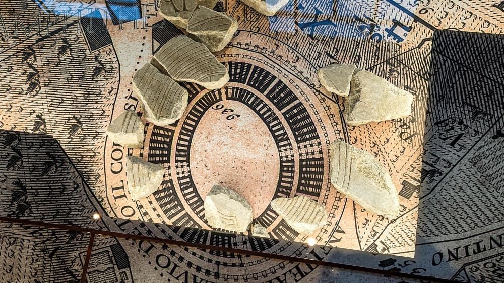
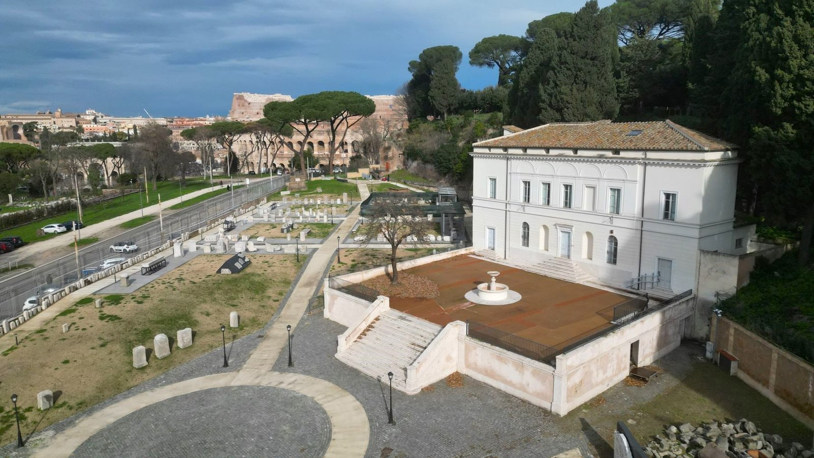
One of the rarest and most important relics that has come down to us from antiquity is the Forma Urbis Romae: a marvelous plan of Ancient Rome engraved on marble between 203 and 211 A.D., under Emperor Septimius Severus, which provides a unique panorama of the city’s urban landscape. It is on display in the brand-new Forma Urbis Museum, opened this year, set within the Celio Archaeological Park, located in a lovely green area overlooking the Colosseum.
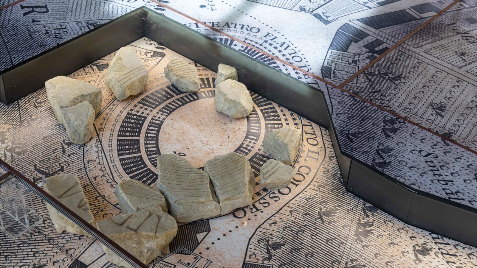
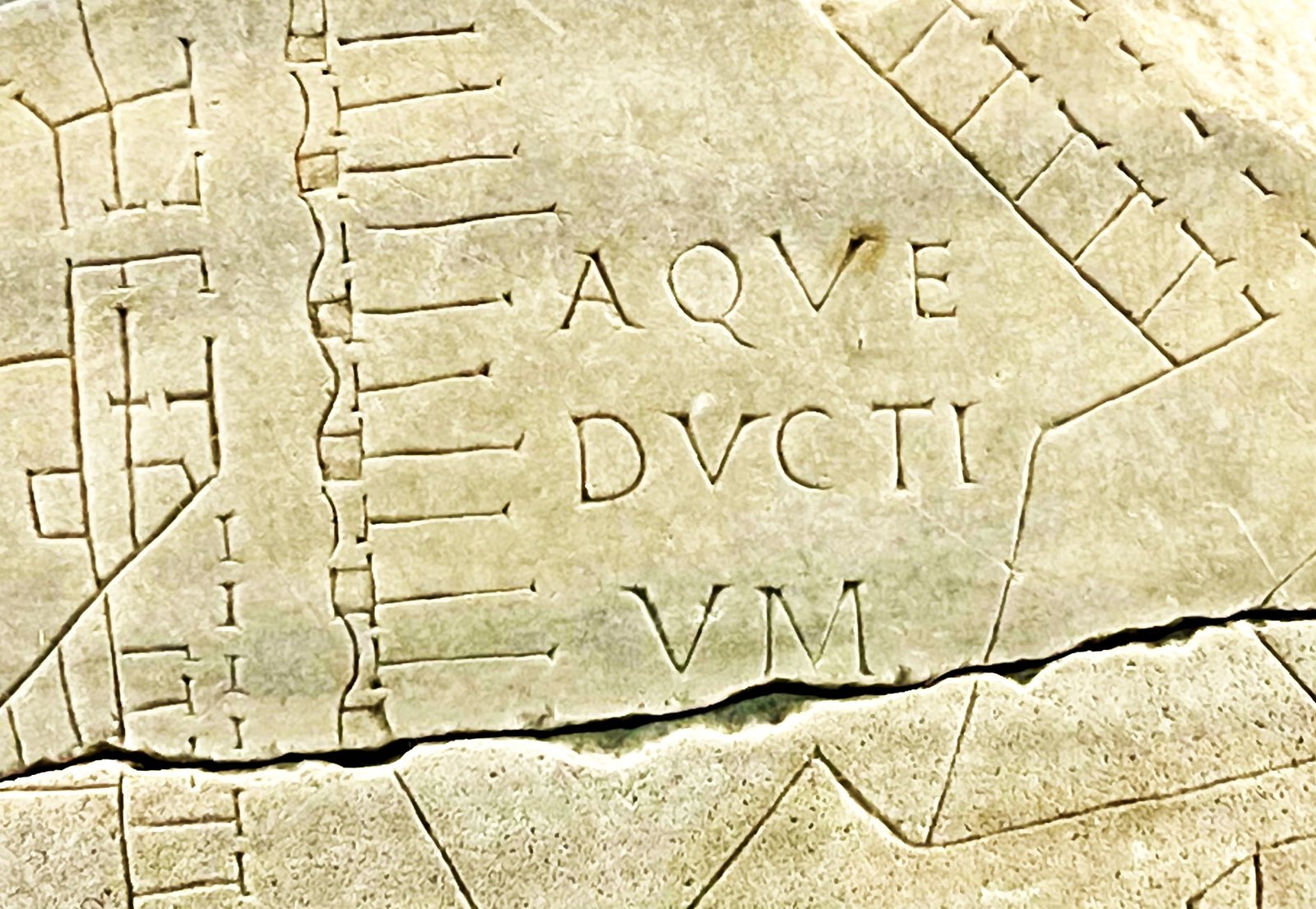
The Forma Urbis was originally placed on the wall of a hall in the Forum of Peace. It was engraved on 150 marble slabs affixed to the wall with iron pins and occupied an area of about 18 by 13 meters and depicted at least 13,550,000 square meters of the city through a multitude of subtle engravings depicting the floor plans of Rome’s buildings, at an average scale of about 1:240.
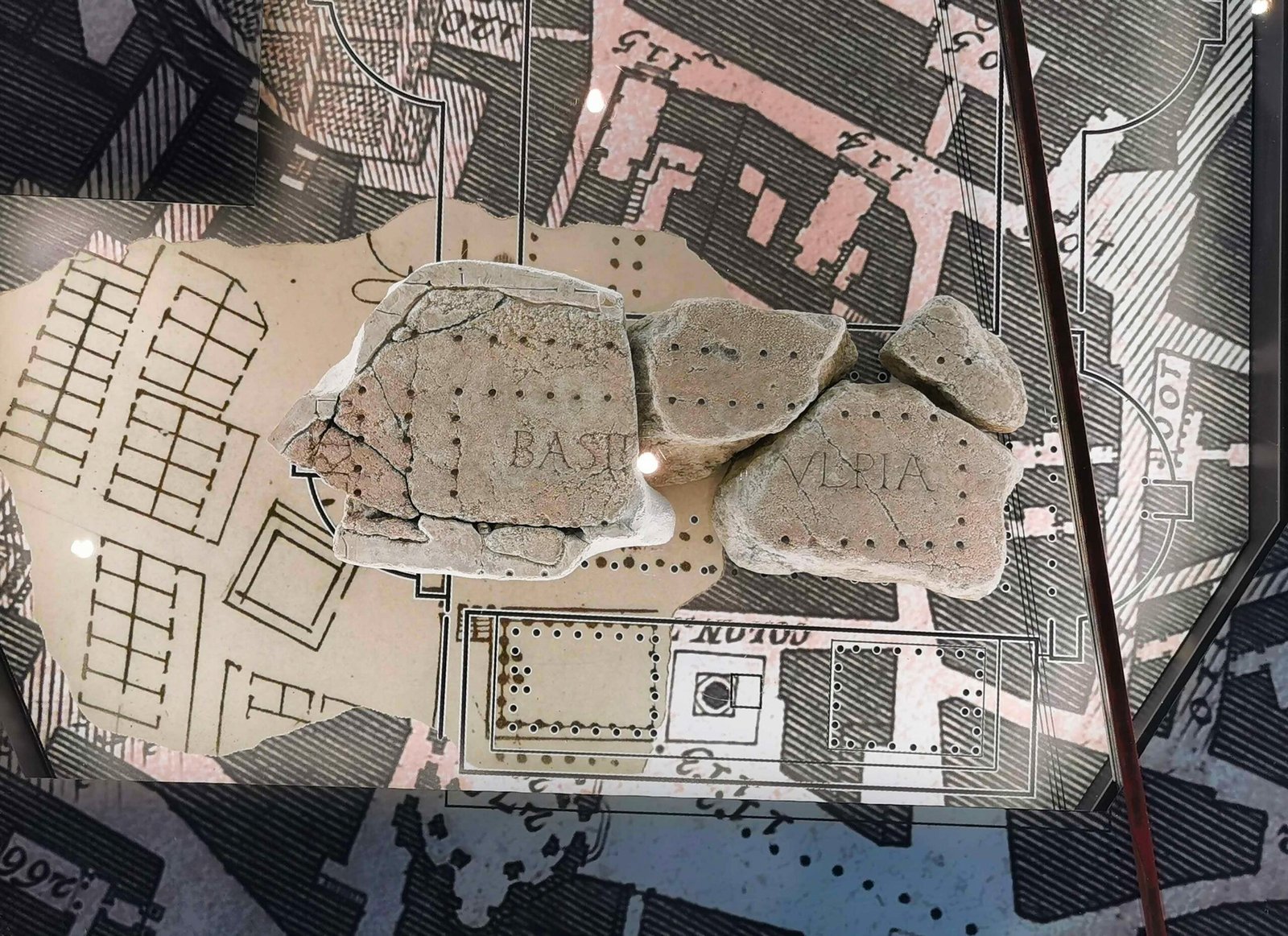
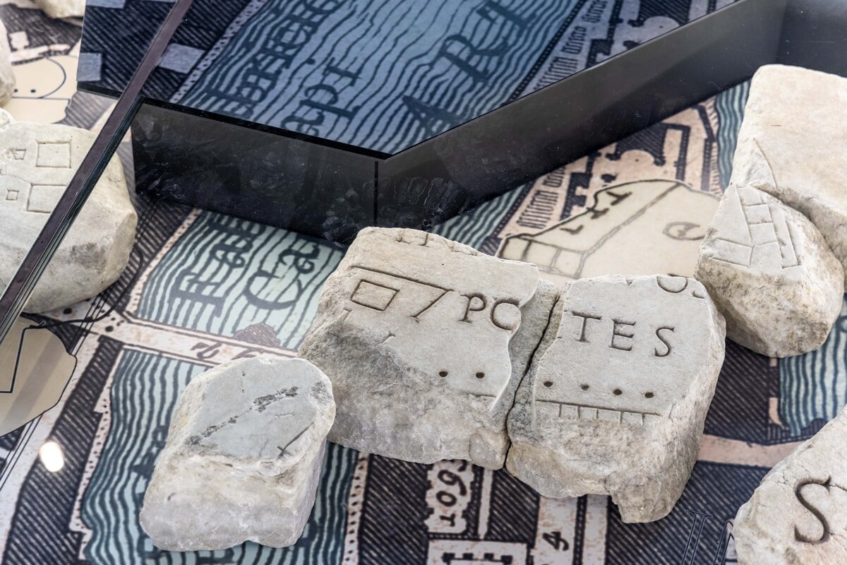
The fragments of the Forma Urbis were discovered in 1562; many of them were lost, but fortunately over 600 of them were found again between 1888 and 1891.
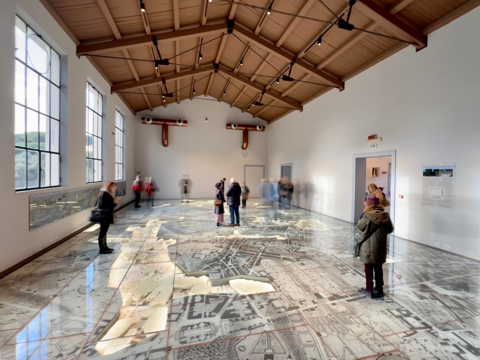
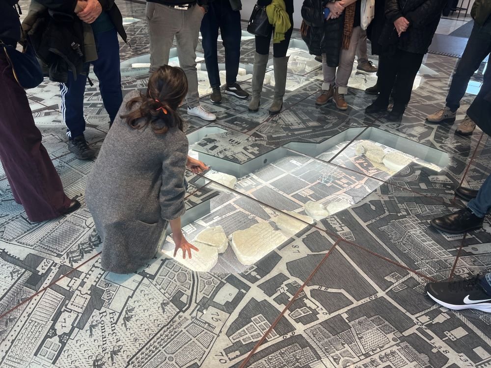
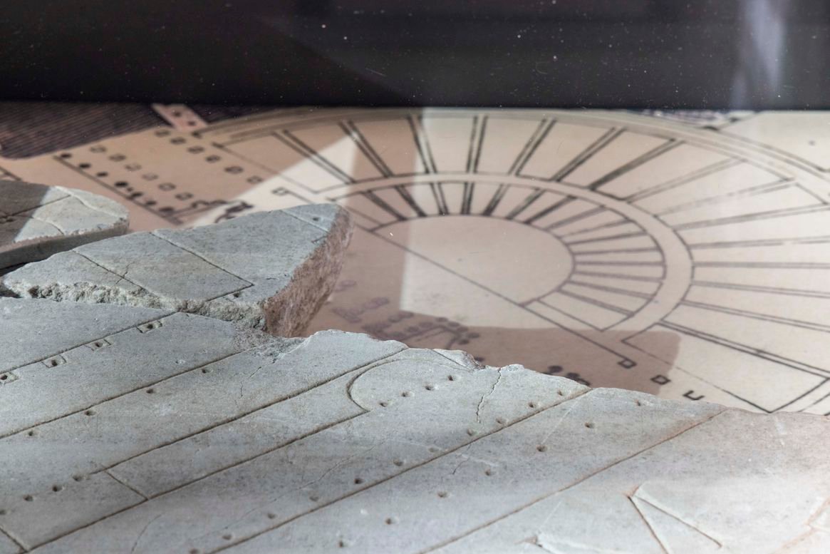
Today, the gigantic planimetry of Ancient Rome returns to the public, after 100 years, in an innovative and exciting display: the fragments of Forma Urbis have in fact been placed on the floor of the museum’s main hall, superimposed on the Pianta Grande engraved by Giovanni Battista Nolli in 1748, the first scientific plan of Rome. The two plans, superimposed, are completely walkable thanks to a transparent surface that protects them: it is really like walking through the streets of Ancient Rome, among entire neighborhoods, houses, porticoes, temples, baths and stores and finding landmarks that are still part of the city of Rome today.